

The Inca Trail is a 27-mile route through the Peruvian Andes that takes four days to complete on foot. It ends at Machu Picchu’s original entrance, the Sun Gate, at 8,924 feet.
The route crosses three distinct ecological zones. You start in the Urubamba Valley at 8,858 feet, where maize grows on terraces and the air holds moisture. By day two, you’re at Warmiwañusca Pass at 13,779 feet, surrounded by ichu grass and rocky outcrops where breathing requires conscious effort. By day four, you’re descending into cloud forest where moss hangs from branches and orchids grow beneath the canopy.
The Route
The trek starts at Piscacucho, kilometer 82 of the railway line to Machu Picchu. The first day covers 7.5 miles along the valley floor, following the Urubamba River upstream. The trail is relatively flat here, passing agricultural communities and the ruins of Patallacta.
Day two climbs 3,937 feet to reach the high pass. Vegetation thins as you gain altitude. Ichu grass replaces cultivated fields. Temperature drops approximately 11°F for every 3,280 feet of elevation. At the pass, wind is common and temperatures can reach near freezing even during the dry season (May through September).
The Inca Sites
The Inca sites along the trail can only be reached on foot. Runkurakay at 12,335 feet is a semicircular structure that served as a tambo (way station) and checkpoint. Sayacmarca rises on a rock with drops on three sides, with stairs carved into the slope and fountains connected by channels that still carry water. Phuyupatamarca preserves tiered ceremonial baths where clouds cover the terraces at dawn. Wiñay Wayna, at 8,694 feet, combines steep agricultural terraces with residential sectors, showing the use of different altitudinal zones.
Inca Engineering on Mountain Terrain
The section of the Qhapaq Ñan toward Machu Picchu demonstrates specific solutions for humid mountain terrain and steep grades.
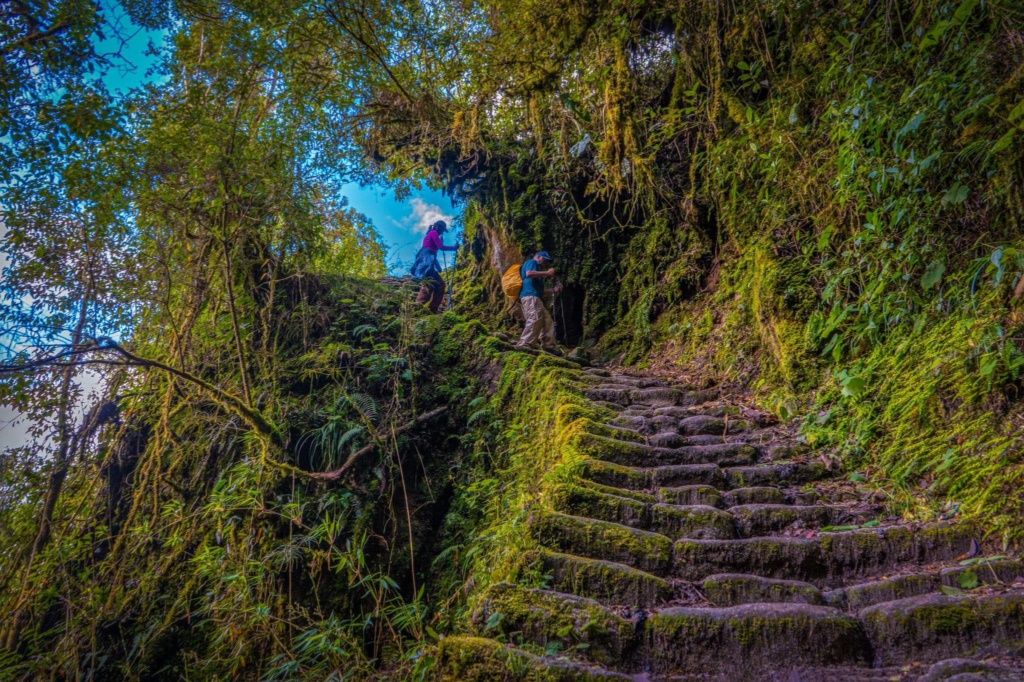
The trail preserves sections of original Inca paving with fitted stones that facilitate drainage. Stairs are carved directly into bedrock. Where slopes drop nearly vertical, retaining walls appear to stabilize the terrain. Drainage channels run parallel to the trail to divert water during the rainy season. In marshy sections, stone causeways raise the walkway above the water table.
The route incorporates ceremonial considerations. Intipunku faces east to receive dawn light during the winter solstice, which marked the start of the Inca ritual year.
Physical Demands and Altitude Considerations
At 13,779 feet, atmospheric pressure is roughly 60% of sea level pressure. Your body receives less oxygen per breath. Common responses include increased heart rate, faster breathing, and reduced physical capacity. Most people experience mild symptoms: headache, fatigue, or difficulty sleeping.
The trek requires cardiovascular endurance rather than technical skill. Daily distances range from 7 to 10 miles, but the combination of altitude and elevation change makes the effort more demanding. Most travelers spend 2-3 days in Cusco (11,152 feet) before starting.
The Inca Trail isn’t inherently dangerous when approached with proper preparation and acclimatization. The main risks relate to altitude rather than technical difficulty, which is why guided tours with experienced operators are required.
People with heart conditions, lung disease, or uncontrolled hypertension should consult their physician before attempting high-altitude treks. This information is general guidance and doesn’t replace individual medical advice.
Trail Organization
The Peruvian government limits permits to 500 people per day, including trekkers, guides, porters, and cooks. Only licensed operators can obtain permits.
Porters carry group equipment (tents, cooking gear, food) while trekkers carry daypacks (11-15 pounds). Porters are regulated by weight limits (55 pounds maximum) and labor standards. Cooks prepare meals at each camp using portable equipment adapted to altitude conditions.
Arriving Through Intipunku
Day four begins before dawn. The walk to Intipunku (Sun Gate) takes roughly an hour on stone paths through cloud forest. Morning fog is common.
Intipunku sits at 8,924 feet on a ridge overlooking Machu Picchu. The citadel sits 656 feet below, surrounded by mountains and the Urubamba canyon. The stone gateway frames the view. In June and July, sunrise aligns with the gate’s axis and illuminates Machu Picchu’s main structures.
After three days of walking, arriving through this entrance provides a different perspective than the train and bus route.
What the Trek Requires
The Inca Trail requires four consecutive days of walking at altitude. Basic fitness is enough: the ability to walk 5-6 hours daily with a light backpack, plus 2-3 days of acclimatization in Cusco. Training 8-12 weeks beforehand with regular hikes, elevation gain, and a weighted pack helps your body know what’s coming.
Walking with People Who Know the Mountain
Several days at altitude, cold nights, and a silent dawn force you to listen to your breathing, measure your pace, and recognize how your body reacts when terrain demands. That kind of trail organizes your attention.
If you decide to turn that curiosity into a trek, it helps to do it with people who know the mountain through continuous use. Many travelers in Cusco rely on local operators like Inkayni Peru Tours, who work these routes year-round and understand how altitude, weather, and group rhythm change. It’s not just logistics: walking accompanied by people who know how to read the mountain makes the journey safer and allows the experience to have clearer meaning for those who live it.